(Royal Bridge Protocol)
What Is The Code?
Operation London Bridge was the plan for what would happen in the United Kingdom after the death of Queen Elizabeth II. All significant Royals have a similar plan. The plan was originally devised in the 1960s and is updated several times each year. It involves planning from government departments, the Church of England, Metropolitan Police Service, the British Armed Forces, the media, the Royal Parks, London boroughs, the Greater London Authority and Transport for London. Some critical decisions relating to the plan were made by the Queen herself, although some can only be made by her successor the current King, her son, after her death.
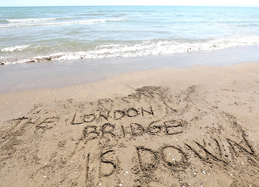
As of early 2017, the phrase "London Bridge is down" was expected to be used to communicate the death of the Queen to the prime minister of the United Kingdom and key personnel, setting the plan into motion.
The codename Operation London Bridge primarily refered to events that would take place in the United Kingdom. In addition to the United Kingdom, other Commonwealth realms where Elizabeth II acted as monarch have developed their own plans for what will happen in the days after her death. These corresponding plans ran concurrently with Operation London Bridge.
How Do Smaller Authorities Comply?
Our understanding is that when the announcement is made from Buckingham Palace, each local authority should provide a landing page with a black background. The page should contain an official image, key dates and a way to get to the main site. This framework contains a feature to do this along with the ability to link to other relevant sites and to be able to place a message from the chairperson/council.
We have extended the standard requirements to also include options for Births & Marriages so the council has full flexibility on significant announcements.